When you click on links to various merchants on this site and make a purchase, this can result in this site earning a commission. Affiliate programs and affiliations include, but are not limited to, the eBay Partner Network.
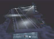
K6403 Sacandaga RiverA view along this lively stream which flows thru and forms the Sacandaga Reservoir, and enters the Hudson River at Luzerne, New York, in the Adirondacks.Color Photo by Richard K. Dean
Manufactured by Koppel Color CardsPublished Natural Color Post Cards by Dean Color Service, Glens Falls, NY
\"The Sacandaga River is a 64-mile-long (103 km) river in the northern part of New York in the United States. Its name comes from the Native American Sa-chen-da\'-ga, meaning \"overflowed lands\".
The Sacandaga River is a tributary of the Hudson River, flowing into it at Hadley, at the border of Saratoga and Warren counties.
The Sacandaga River\'s headwaters north of Great Sacandaga Lake begin in the town of Lake Pleasant. From Lake Pleasant, the river follows a short moving course or path known as the Sacandaga Outlet[3] (under New York Route 8) into Lake Pleasant. The Sacandaga River drains Lake Pleasant at a location next to the public beach in the village of Speculator. The river then follows a winding path through some wetlands and various ecosystems through the county. In Speculator, the Sacandaga River Community Park was built by local volunteers and has a number of boardwalks and pathways that follow the course of the river.[4]
Near the town boundary between Wells and Lake Pleasant, the river flows into a series of ponds. The Sacandaga River course takes a steep path flowing over a series of waterfalls including Christine Falls, Austin Falls and Auger Falls.
The East Branch joins the trunk stream in the town of Wells. After flowing through Wells, the river enters Lake Algonquin, a manmade impoundment constructed in the 1920s to stimulate the community\'s tourism industry. The East Branch goes through Johnsburg in Warren County and flows parallel to, in part, NY Route 8, passing the communities of Oregon in Johnsburg and Griffin in the town of Wells.
The Sacandaga flows out of Lake Algonquin into a hydro-electric plant and follows a course of rapids to Great Sacandaga Lake through the towns of Hope and Benson.[4] In that area, it connects with Groff Creek. Then it enters the Great Sacandaga Lake in the village of Northville, which it flows through the lake to the Conklingville Dam. Which then it enters the town of Hadley, where it ends at the Hudson River. Downstream of Stewart\'s Dam in Hadley, recreational releases are held by Brookfield Energy, creating a two-mile Class II whitewater run to the Hudson River for local paddlers.
HydrologyThe United States Geological Survey (USGS) maintains a few stream gauges along Sacandaga River. The one station located 4.5 miles (7.2 km) upstream from Hope, had a maximum discharge of 32,000 cubic feet (910 m3) per second on March 27, 1913, and a minimum discharge of 16 cubic feet (0.45 m3) per second on September 30, 1913.[5] Another station located 1.4 miles (2.3 km) upstream from the mouth in operation since 1907, had a maximum discharge of 35,500 cubic feet (1,010 m3) per second on March 28, 1913, and a minimum discharge of 4.2 cubic feet (0.12 m3) per second on May 4, 1985, March 30–31, and many days in April 1992. Since the construction of Great Sacandaga Lake in 1930, the maximum discharge was 16,500 cubic feet (470 m3) on May 2, 2011.[6]Tributaries
RightJohnson Vly StreamShanty BrookDunning CreekWest Branch Sacandaga RiverGroff CreekPetes CreekWest Stony CreekCloutler CreekBatcheller CreekGordons CreekDaly CreekBreen Brook
LeftKunjamuk RiverFly CreekRobbs CreekMacomber CreekEast Branch Sacandaga RiverMill CreekCoulombe CreekDoig CreekEast Stony CreekBeecher CreekSand CreekGlasshouse CreekPaul CreekAllentown CreekBell BrookMink BrookMan Shanty Brook
Dam and reservoirThe Conklingville Dam, finished in 1930, located by the west town line of Hadley, greatly expanded the width of the river, creating Great Sacandaga Lake, formerly called the Great Sacandaga Reservoir.\"- Wikipedia
\"Lake Luzerne, formerly the Town of Fairfield and then Luzerne, is a town in southern Warren County, New York, United States. The town is located within the Adirondack Park. The town is part of the Glens Falls Metropolitan Statistical Area. Lake Luzerne is west of the city of Glens Falls. The town population was 3,079 at the 2020 census.
HistoryThe area received its first permanent European settlers around 1770. The town of Lake Luzerne was set off from the town of Queensbury in 1792 as the Town of Fairfield. The town is named after Anne-César, Chevalier de la Luzerne, who guaranteed a personal loan to provide food to American revolutionary troops and who served as a French Minister to the new country.Perspective map of Luzerne and Hadley, New York with list of landmarks from 1888 by L.R. BurleighIn 1808, the town changed its name to Luzerne and in 1963 to Lake Luzerne.
The town is known for its Adirondack Folk School, with classes designed to keep the arts, crafts and culture of the Adirondacks alive , and for the Lake Luzerne Chamber Music Festival where artists such as classical guitarist Joel Brown, the Imani Winds, violinist Raymond Gniewek, saxophonist Erk Rist, jazz greats Chris and Dave Brubeck, and the Philadelphia Orchestra perform during the summer months. Every year, children from across the world compete to participate in music camps at the Luzerne Music Center, where free concerts are offered to the public.
Woodward Hall was listed on the National Register of Historic Places in 2014.
Lake Luzerne is also the home of the Painted Pony Rodeo, the award winning Nettle Meadow Cheese Shop offering Kunik cheese, and the Double \"H\" Ranch, founded by Charles R. Wood and the actor, Paul Newman. The ranch provides specialized programs and year-round support for children and their families dealing with life-threatening illnesses. The Ranch\'s purpose is to enrich their lives and provide camp experiences that are memorable, exciting, fun, empowering, physically safe and medically sound.
GeographyAccording to the United States Census Bureau, the town has a total area of 54.1 square miles (140 km2), of which 52.6 square miles (136 km2) is land and 1.4 square miles (3.6 km2) (2.66%) is water.
The southern and western town lines are the border of Saratoga County and the Hudson River. The northern town boundary is the border with the town of Warrensburg. The eastern town line is the border with the towns of Queensbury and Lake George.
Just north of the bridge across the Hudson, to Hadley, is the narrowest point of the entire Hudson River, Rockwell Falls. Just to the south is where the Sacandaga River meets the Hudson.\"- Wikipedia
\"Come to the Town of Lake Luzerne, NY to enjoy a confluence of waters. Here, the Hudson River squeezes into a narrow gorge and tumbles over the dramatic Rockwell Falls. Water from the Great Sacandaga Reservoir joins the Hudson in a flurry of white water. Further downstream, the river widens into “The Bay,” a stretch of water broad enough for water skiing. For those who seek quieter waters, a chain of four beautiful lakes offer fishing, camping, boating, and swimming, with two public swimming beaches on Lake Luzerne itself.
The Town of Lake Luzerne, NY has catered to visitors since President Grant traveled here for rest and recreation after the Civil War. The grand old hotels of that day have given way to modern inns and restaurants, new tennis and basketball courts, a miniature golf course, three local history museums, two riverside parks, summer concerts, and craft shows offer a variety of family fun.
Lake Luzerne is also the home of a worldwide renowned music camp. In winter, snowmobilers can ride over 200 miles of forest trails. Signs for the “Dude Ranch Trail” hearken back to the days after World War II, when the old logging camps found new life as Dude Ranches. The Rodeo is still going strong after more than 60 years and several stables along Route 9N still offer horseback Great Sacandaga Lake is a 29 mile long reservoir in the Adirondack Mountains.STATISTICS Surface Area: 42 Square miles Shoreline: 125 miles Maximum Width: 5 miles Water Capacity: 37.75 billion cubic feet Length: 29 miles ( Lake George is 32 miles) Average Depth: 40′ Maximum Depth: 65′-90′ at the Conklingville Dam.